Flying the Grand Canyon
 |
| Grand Canyon National Park |
Half an hour later, we approach Grants, NM, the second and final stop of the day. Wes, the FBO, says “Wind 220 degrees at 20 kts, gusting to 27.” Oh my, the single runway at Grants is 13-31, so this is a severe 90 deg crosswind. As a safeguard for that situation, we have planned as alternate the Double Eagle airport in Albuquerque, which lies 55 nm east and has two runways.
But before we give up on Grants and go to the backup plan, we call back for verification. Wes says “The winds are bouncing around. Wind is now 170 degrees at 18 kts, gusting to 24.” For runway 13, this is an easily managed crosswind. We line up for final and hope that the favorable wind direction will hold. Indeed it does. We land, taxi to the hangar already opened by Wes, and push the plane inside to get it out of the fierce wind. Then comes a deep breath of relief.
How did we get into that situation? It starts easy enough. My son Martin and I have planned to fly to the Grand Canyon, AZ. The month of May seems the perfect time since temperatures will be moderate and we will avoid the tourist rush of the summer.
We start with an uneventful flight from the Aero Country airport north of Dallas to the Double Eagle airport in Albuquerque, and stay over the weekend with daughter Ingrid. At daybreak the following Monday, we begin the final leg to the Grand Canyon.
In past trips going west from Albuquerque, we had always followed the meandering Interstate 40 to Flagstaff. There were two reasons for that choice. The route is scenic, and the interstate offers a perfect landing site in case of plane difficulties.
But the Rotax engine has proved to be quite reliable for 1400+ hours, so this time we proceed directly west to the Grand Canyon, leaving the interstate south of the route. It turns out to be an excellent decision.
We cross forested mesas and sandstone deserts painted white, yellow, ochre, and red. Extinct volcanoes covered with pale-green shrubs rise from the desert and add to the palette of colors. As we get close to the destination, the Little Colorado River meanders northbound with lush green banks.
The pine forest of Grand Canyon National Park comes into view. Runway 13 of the Grand Canyon airport is in use. It has a significant downhill slope, but our redesigned brakes slow us down reliably.
The FBO personnel is most helpful. That’s needed, too. The airport has both GA and commercial flights. Homeland Security has decided that nobody can walk anymore on the tarmac from the GA parking area to the terminal.
Even just going from the plane to the restroom, a ritual required immediately after any long flight, can only be accomplished via a cell phone call. The FBO van fetches us at the parked plane, drops us off at the main building, and after relief brings us back to the plane for unloading and tie-down.
Car rental at the Grand Canyon airport has disappeared, since GA traffic has fallen off precipitously. The large GA parking area holds just three planes: a Lancair, a Cirrus, and our Zenith 601HDS, N314LB. Maybe $7/gal Avgas has something to do with it.
But there is no reason to fret about transportation. The FBO delivers us to the hotel in the nearby village of Tusayan, and Grand Canyon National Park operates shuttle buses from Tusayan into the park and, within the park, to various sites along the South Rim. We make extensive use of the efficient system.
The first day we hike from the Bright Angel trailhead down to Indian Garden. The trail is 4.5 miles one way and drops 3,000 ft.
 | |
| Start of Bright Angel Trail |
Back to the story of the hike. Walking downhill is fun and easy. At the start, we shiver in the cool morning air of the South Rim. But the temperature rises rapidly during the descent.
 |
| Steepest portion of Bright Angel Trail |
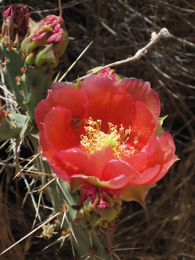 | ||
| Red Prickly Pear cactus |
 |
| Whitestem Paperflower near Indian Garden |
 |
| Western Redbud canopy |
 |
| Cottonwood trees succumbing to age, Indian Garden |
We eat a leisurely lunch and talk and relax till 3 pm before attempting the hike back up. This is a prudent decision since the midday sun has turned the trail into a baking oven.
 |
| Beginning the ascent from Indian Garden |
 |
| Approaching rest house on hike up |
Going up, young hikers have blazed past us. But folks of more mature age pace themselves just as we do. On the way up, we meet them time and again as they or we rest. “Hello, nice to see you again”, “Hello, have we met before?” , and “Hi, you look familiar” are repeated greetings.
 |
| Repeated encounters |
During the next two days we hike much of the South Rim, first going east with the shuttle and walking back to the Visitor Center, then hiking west and returning via the shuttle.
 |
| Morning, South Rim |
 |
| Firecracker Penstemon |
 | |||||
| Golden Ragwort, South Rim |
 |
| Cliff Rose, South Rim |
 |
| Battleship Mountain, seen head-on and ... |
 |
| ... from the side |
 |
| History Room of Bright Angel Lodge |
 |
| Lookout Studio designed by Mary Colter blends into South Rim landscape |
In recent years, the California condor, which is the largest land bird in North America, was reintroduced into the canyon.
 |
| California condor over upper part of Grand Canyon (photo courtesy Jesse Varner) |
 |
| Ranger monitoring feeding of nestling California Condor |
 |
| Story of Orphan Mine |
 |
| Trail of Time |
A special map, the Grand Canyon VFR Aeronautical Chart, has those rules for air tour operators on one side and for general aviation on the other. The map is not always available from suppliers of navigational charts. mypilotstore.com sells it for $3.95. Here is a portion of the map side for general aviation.
 |
| Grand Canyon VFR Aeronautical Chart |
The map does not tell the rules applying outside the corridors, but implicitly they are the cited general VFR altitude rules.
The canyon area is subdivided into several subareas by blue lines. Within each subarea, the pilot must stay above a specified minimum altitude and monitor a frequency that is also used by the tour operators flying at lower levels.
Navigation in the canyon area just by sight should not be attempted due to the lack of landmarks identifying the purple excluded areas. Instead, GPS should be used. We use the Grand Canyon VOR and the Tuba City airport just east of the park for reference radials and distances, and the Colorado river as additional marker. Due to strong winds, we employ the autopilot to guarantee that course directions are closely maintained.
Taking off from the Grand Canyon airport, we fly east and climb outside the canyon area. We pass 10,000 ft MSL as we near the Little Colorado River. At that point, we continue to climb but also turn north, thus beginning to overfly the canyon area. Once we are about 30 miles northwest of Tuba City, we reach the Colorado River near the northern end of the Zuni Point Corridor. We turn south and fly the corridor at 10,500 ft MSL as demanded by the special VFR rules. Since the sun has just begun rising in the east, we should have an excellent view of the canyon to the west. But unfortunately there is morning haze. We include a photo taken a year ago when we had no haze.
 |
| Grand Canyon, Zuni Point Corridor |
 |
| Marble Canyon, view to North |
 |
| Marble Canyon, view to South |
The disturbing prediction turns out to be correct near ground level, but fortunately is wrong higher up. Thus, the takeoff from the Grand Canyon airport and the landing and takeoff in Page are in bumpy air. But as soon as we reach 3,000 ft AGL, the air is smooth even though winds are very strong.
From Page, we proceed east to Grants. The southwesterly winds are so powerful that we need a 30-40 deg course correction for wind. Still, we have a slight tailwind component.
A dust storm rises to the east during the first half on the leg. We manage to remain over forested land and are not affected. A second dust storm develops near Gallup as described earlier. Flight Watch is pleased to receive our pilot reports of the two dust storms.
After landing at Grants, FBO Wes tells, “Winds tomorrow are forecast to be 50 kts.” A scary prediction. Undaunted, we rise at 4 am, get the weather forecast, file the flight plan, and take off just before the sun rises above the Sandia Mountains in the east. The weather is exactly like the day before. Bumpy air near the ground gives way to strong but smooth winds at 9,500 ft MSL, our cruising altitude. Despite a large course correction for the wind, we have a small tailwind component. The same weather prevails at the refueling stop in Plainview, TX, and on the final leg to Aero Country airport.
A comment on landing with strong winds and gusts. The usual rule is, “Add half the gust factor to the landing speed.” Barry Schiff, a very experienced pilot writing for AOPA Pilot, suggests an alternate rule: “Fly final of the traffic pattern with GPS ground track speed equal to landing speed.” This rule guarantees that there will be no gust-induced stall. This is the day to try it out. As expected, airspeed on final is somewhat high while ground speed matches landing speed. Once over the threshold and low over the runway, we pull the throttle, air and ground speed drop off rapidly, and the touchdown is gentle despite the turbulent air. It is a simple, neat, and safe rule that does not require knowledge of the gust speed.
What else have we learned? Spring flying in the Southwest can be a great experience. But if strong winds are predicted, the route should not be over sandy desert. Sand storms may suddenly rise and quickly clog up the air filter of the engine.
Lastly, sand storms can be deceptive. After we had filed the first pilot report, we heard the Flight Watch specialist advise another airplane about the sand storm, citing our report. The pilot responded, "I do not believe this is dust. It seems to be just some smoke." We hope that he did not come to grief due to this wrong assessment.
Have any questions or feedback about flying the Grand Canyon? Please share your thoughts in the comments.


Comments
Post a Comment