Posts

Fly-Walk-Hike the Grand Canyon in Arizona

Image
  View of Grand Canyon from South Rim Visiting the South Rim of the Grand Canyon, AZ used to be easy. One would fly to the Grand Canyon airport (GCN) and pick up a rental car to get around.  One could stay at any of a number of hotels in Tusayan, which is right next to the airport, or at one of the campgrounds. Then one would drive to the South Rim of the Grand Canyon National Park every day.  As an alternative, one could take a shuttle from the airport to Tusayan, then continue daily with a bus from Tusayan to the South Rim and back. T hat bus service was discontinued in 2021. For a number of years, rental cars have not been available at the Grand Canyon airport, except for an offer with an exorbitant daily rate. The nearest car rental with reasonable rates is at the Flagstaff, AZ airport, about 70 miles away. How can you then fly there and visit with minimal fuss?  Three Options There are two ways where you fly into the Grand Canyon airport and take a reasonably pr...

The Stark Beauty of New Mexico

Image
View toward Mimbres, NM   In ea rly summer 2021 we visited friends Lynn and Philip in Mimbres, NM. A hike up the nearby mountain once more demonstrated the stark beauty of southern New Mexico as well as the harshness of life for some of the animals.  Here are some pictures. Beauty reaching toward the sky... 10 ft tall Yucca ... and close to the ground. Thistles On the return hike we descended in an arroyo. Suddenly we came upon a demonstration that life is harsh for many of the animals. Remains of a small deer The deer probably was overcome by a mountain lion. Just 200 ft further down, we were surprised by the remains of another small deer. Bones of another small deer Both cases are a reminder that the safety we have created for our existence doesn't extend to the world of animals. Many of them live in constant danger. It was a sobering reality check. Then another thought popped up. On the trip from Dallas to Deming, NM for the visit, we flew under a 1,500 ft ceiling at 1...

Rendezvous at Lakeway Airport

Image
  Lakeway Airport 3R9 The COVID-19 virus has thrown a wrench into family gatherings. For Thanksgiving, this was really sad. But there is a cure: Hop into your airplane, fly to an airport near family, and meet them at the airport with social distancing. Did just that: Flew from Dallas to the Lakeway airport (3R9) near Austin and met with son Martin. It was a perfect day: Clear sky, reasonable temperatures in the 60s, modest tailwind going to Lakeway flying at 2,500 ft, and then another tailwind going back in the afternoon at 5,500 ft. Lakeway airport terminal Distance about 200 nm one-way, took a bit more than two hours for each trip. Son Martin brought two lawn chairs. We sat next to the terminal building in the shade, out of the wind, and had a great time together. Am writing about this since that airport is a lovely place to meet. The runway is in excellent condition, though there is a rise in the middle and you cannot see the other end. Hence radio communication about entering a...

Colorado and Utah Wonderlands: The Dolores and Colorado Rivers

Image
  The Dolores River near Dove Creek The COVID-19 has forced an unwelcome simplification of life style. For example, it has ruled out commercial air travel for the entire family. As an antidote, daughter Ingrid and I went on a full-day excursion trip with our Zenith 601HDS, with homemade sandwiches for lunch. That way, we traveled quite some distance, but avoided hotel stays and restaurant visits. All photos of this trip were taken by Ingrid. We mixed in three photos from an earlier trip to add some vistas. The Route We start in my daughter's hometown, Albuquerque, NM and head north. The first refueling stop is in Cortez, CO.  Continuing north, we trace the Dolores River all the way to the Colorado River. Then flying west along the Colorado, we land at Canyonlands airport near Moab, UT for a second refueling. A final, long leg brings us back to Albuquerque. Below is the portion of the route from Cortez to Canyonlands airport. Route from Cortez, CO to Canyonlands airport near Mo...

We Go West But Not Viral

Image
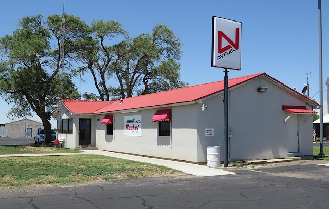
FBO of Hale County airport, Plainview, TX If there ever was an understatement for the year 2020, it is "The COVID-19 virus is affecting our lives." Yeah, like staying home almost continuously for weeks and weeks. So, we decided to do something about it: A flight to visit daughter Ingrid in Albuquerque, NM. We called the FBO in Plainview, TX to inquire how they handled refueling. Then contacted Albuquerque about refueling and hangar storage. Both answers satisfactory: Masks in use, a promise to keep distance. But that really isn't good enough. What happens when we enter the FBO building? The air in the building, surfaces in the office, and restrooms? So we decided to work out a system that eliminates potential virus transmission as much as possible. The key is: Do not enter the FBO building during refueling. That requires some care. Fuel Input As we were about to land in Plainview, we requested refueling with the fuel truck, as opposed to self service. ...

Two Airport Gems of the East Coast: Florala, AL (0J4) and Marianna, FL (MAI)

Image
We are on a two-day trip from Dallas to the Tampa, FL area. For day 1, we have planned to reach Marianna, FL. Starting at the Aero Country airport at 8 am, the first leg brings us to Vicksburg, MS around noon. We refuel, take off, climb to our cruising altitude of 5,500 ft, open the Garmin Pilot on the iPad to look at the weather ahead, and are in for a surprise. Minor thunderstorms northeast of Marianna have begun to blossom and start to form a thunderstorm cluster. The intense lightning and heavy rain is moving southwest and will engulf the airport before we get there. We use the Garmin Pilot to check out alternate airports along our route: We go to the airport page, bring up the airports one by one and look for runway conditions, available fuel, and NOTAMS (Notices to Airmen), which tell about special facts and conditions affecting landing and takeoff. The autopilot takes over navigation during that checking process, and the ADS-B system informs us about any airplanes near u...